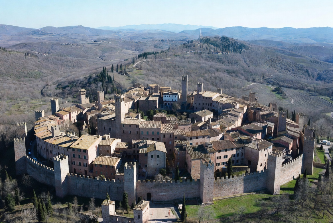
Which Section of the Via Francigena Should You Walk? Tuscany, Stage by Stage
Which Via Francigena section to walk in Tuscany — every stage compared by distance, difficulty and water, plus the new 2026 section certificates.
In this guide
Quick answer
Search "best section of the Via Francigena" and you will find tour operators selling packages, not answers. Here is the answer, free.
If you have a week: walk Lucca to Siena. It is 133 kilometres over six official stages, it threads Lucca, San Miniato, Gambassi Terme, San Gimignano, Monteriggioni and Siena, and — this is new — operators have sold it as a "7 nights, 133 km" package for years — and since May 2026 it is also an officially recognised section with its own certificate. Either way, they are all selling the same six stages you can walk independently.
If you have one day: Monteriggioni to Siena, the classic finish, which has its own guide on this site. If you have one day and want the prettiest three hours: Gambassi Terme to San Gimignano, 13.4 km, easy, arriving at the towers on foot.
If you want the Rome certificate, none of the Tuscan stages will earn it: the Testimonium in Rome still requires the last 100 km on foot, which means starting at Viterbo in Lazio.
And the honest warnings, in one place: the Monteriggioni–Siena stage is short and easy but has almost no water or food en route; the San Gimignano–Monteriggioni stage is 31 km and defeats people who read "one day"; the hardest Tuscan stage is San Quirico d'Orcia to Radicofani, which ends with roughly 12 km of sustained exposed climb; and Tuscan clay after rain is its own hazard. Walk April–May or September–October, never July or August.
The 2026 change that reshapes how you plan
For most of its modern life the Via Francigena had one reward at the end: the Testimonium collected in Rome, earned by walking the final 100 kilometres. That structure served the through-hiker and nobody else — which is to say, it served almost none of us.
In May 2026 the European Association of the Via Francigena Ways (AEVF) restructured the Italian route into seven sections, each walkable in roughly five to eight days, and each with **its own issuing point for the *Testimonium laico* — the lay pilgrim certificate, now awarded per section as well as in Rome: Ivrea, Pavia, Fidenza, Lucca, Siena**, Viterbo and Rome. (Coverage of the announcement disagreed on whether that meant six new points or seven — the likeliest reading is six new cities plus Rome, which already issued the original certificate.)
Three details make this genuinely useful rather than administrative. The section Testimonium is free, can be walked in either direction, and does not have to be completed within a single calendar year — so stages accumulated across several holidays still count. Completion is verified through stamps on the official AEVF credential; other credentials are not accepted. For a traveller with a week rather than a season, the Francigena just became a route you can finish something on.
The seven sections and their official lengths, as published: Gran San Bernardo–Ivrea (7 stages, 110 km); Ivrea–Pavia (7, 141); Pavia–Fidenza (5, 119); Fidenza–Lucca (8, 211); Lucca–Siena (6, 133); Siena–Viterbo (7, 161); and Viterbo–Rome (5, 108). The two that matter for a Tuscan trip are the fifth and sixth — and the fifth is the one to walk first.
The Tuscan route in one picture
Tuscany carries the longest and best-waymarked stretch of the Italian Francigena: officially 380 kilometres across 39 municipalities in 15 stages, from the Passo della Cisa in the northern Apennines down to Radicofani on the Lazio border, opened by the region as a "Grande Itinerario Culturale". (The Regione Toscana framing is 380 km, 39 municipalities and 15 stages ending at Radicofani; counts that run on to Acquapendente reach 16 stages and 38 municipalities, and one 2014 report gave 385 km. The differences are about where the regional boundary is drawn, not about the road itself.) In the AEVF's national numbering these are legs 22 to 36.
The shape of it, north to south: the Lunigiana mountains and Pontremoli; the coastal plain past Massa and Camaiore; Lucca, the first great pilgrim city; the flatter Valdinievole and Altopascio; San Miniato on its ridge; then the classic Tuscan sequence — Gambassi Terme, San Gimignano, Monteriggioni, Siena — before the road turns south through the Val d'Arbia and Val d'Orcia to San Quirico and the climb to Radicofani.
Almost everything sold commercially, and almost everything worth walking on a first visit, sits in the middle third of that list. The stages below are the ones you will actually choose between.
The stages that matter, compared
Gambassi Terme → San Gimignano (Leg 31) — the prettiest short day. 13.4 km, about 3 hours, rated easy, with 344 m of altitude change and a surface breakdown of roughly 40% paved road, 54% dirt road and track, 6% rougher path. It rolls through vineyards and past country churches, and it ends with the towers of San Gimignano rising ahead of you for the last hour — the single best arrival-on-foot in Tuscany after Siena itself. Trailhead access without a car is the catch: the nearest stations are Certaldo and Castelfiorentino, each about 10 km away on the Florence–Siena line, with local bus links into Gambassi.
San Gimignano → Monteriggioni (Leg 32) — the marquee stage, and a trap. 31 km, about 7 hours, one of the longest legs on the entire Canterbury–Rome route, and described by the regional tourism board as one of its most beautiful. Walkers' GPS traces broadly agree at just over 30 km. Do not attempt it as a casual day out: it is a full walking day with a heat problem in summer and a mud problem in spring. There is an official Colle Val d'Elsa variant that splits it sensibly into two days, with Abbadia a Isola — the old abbey on the plain below Monteriggioni — as the classic final approach.
Monteriggioni → Siena (Leg 33) — the famous finish. Officially 18 km and about 6 hours; walkers' GPS traces run 20.5–21 km, and the honest planning figure is "around twenty kilometres, five to six hours". It runs on the strade bianche of the Montagnola Senese past the abandoned medieval village of Cerbaia and the castles of Chiocciola and Villa, drops to Pian del Lago, and enters Siena through the Renai woods. Its defining problem is supplies, not difficulty: the stage is easy underfoot but has an almost total absence of water and refreshment points — the La Villa rest point is one of very few — so carry everything. Our dedicated day-walk guide covers this stage in full, including the bus out and the arrival into the city.
Siena → Ponte d'Arbia (Leg 34) — the quiet one. 26 km on the unpaved roads of the Val d'Arbia, big-sky farmland walking with fewer walkers and fewer distractions. The stage where the route stops being a sightseeing corridor and starts being a pilgrimage.
Ponte d'Arbia → San Quirico d'Orcia (Leg 35) — the Val d'Orcia entrance. 26.25 km, about 6 hours, delivering you into the postcard valley on foot, which is a very different experience from driving its viewpoints.
San Quirico d'Orcia → Radicofani (Leg 36) — the hardest stage in this comparison. 33 km and roughly 7¼ hours, officially rated *impegnativa* with around 900 m of ascent, finishing with a long, exposed gravel climb from the abandoned hospice of Le Briccole up to Radicofani at 790 m. Reserve it for fit walkers in good conditions, and never in high summer. (Beyond it, Leg 37 to Acquapendente opens with an 8 km ridge descent and leaves Tuscany at Ponte a Rigo.)
Choosing by how much time you have
One day, easy → Gambassi Terme to San Gimignano. Three hours, gentle, and it ends in one of Tuscany's great townscapes. Best half-day introduction to the route there is.
One day, classic → Monteriggioni to Siena. Around twenty kilometres, out by bus on the morning 130 or 131 to the Colonna di Monteriggioni stop, then walk home into the city. Carry water; there is next to none. Full guide here.
A long weekend (2–3 days) → San Gimignano → Colle Val d'Elsa → Monteriggioni → Siena. Splitting Leg 32 at Colle makes this humane — our Colle guide covers the town — and it strings together three of Tuscany's most photogenic arrivals in a row. This is the single best short-break itinerary on the Tuscan Francigena.
A week (6 days walking) → the full Lucca–Siena section, 133 km. Lucca's walls to Siena's Campo, ending with a section certificate under the new 2026 scheme. Every operator's flagship product; entirely walkable independently with the official app and booked accommodation.
Two weeks → Lucca to Radicofani, adding the Val d'Arbia and Val d'Orcia stages and finishing on the route's hardest climb — or continuing into Lazio.
Chasing the Rome Testimonium → none of the above qualifies. The Rome certificate requires the last 100 km on foot (200 km by bicycle), verified by credential stamps, which conventionally means starting at Viterbo — 108 km out on AEVF's own section data, and sold by operators as a 112 km walked itinerary. Walk Tuscany for Tuscany; walk Lazio for the certificate — or now, walk Tuscany for the section certificate at Lucca or Siena.
Credentials, stamps and certificates
The credenziale — the pilgrim passport you collect stamps in — has a recommended price of about €8, sold through the official viefrancigene.org store (with shipping added) or picked up at distribution points along the way. In Siena it is issued at the Santa Maria della Scala bookshop (Palazzo Squarcialupi entrance, Piazza Duomo 1, daily 10:30–18:30), with a second outlet at the Libreria Catechistica, Via dei Fusari 46 — fittingly, since the complex was medieval Europe's largest pilgrim hospital and the traditional end of the Tuscan road.
Beyond sentiment, the credential carries published transport concessions — 10% off regional tickets with Trenitalia and Trenord, and 10% across FlixBus's European network — alongside access to pilgrim hospitality and discounts with affiliated businesses, which vary by provider.
The certificates, restated clearly because the change is recent: the Testimonium in Rome requires the final 100 km on foot and is collected at a pilgrims' reception point at St Peter's. The section certificates introduced in May 2026 are earned by completing one of the seven Italian sections — for Tuscan walkers, Lucca–Siena (issued in Siena) or the Fidenza–Lucca section before it — reported as free, walkable in either direction, and accumulable across more than one year.
For navigation, the official Via Francigena app published by AEVF is free, covers the whole Canterbury–Rome route with downloadable offline maps and geolocated stage data, and is the standard planning tool — better, for route-finding, than any operator's printed pack. On the ground, the waymark is a white pilgrim on a red ground, appearing as signposts, small concrete milestones and stickers alongside red-and-white CAI-style flashes; a white arrow with a yellow pilgrim marks a variant rather than the main line.
When to walk, and the two hazards nobody sells you
Walk April–May or September–October. Daytime temperatures in the mid-teens to low twenties, long enough days, and the countryside at its best in both directions — the spring green or the harvest gold. July and August are widely advised against, and the reason is not comfort but water: several Tuscan stages have almost no refreshment points, and the Tuscan summer is not a place to discover that at kilometre fifteen. Winter brings mud and short days.
Hazard one: the clay. Tuscan soil after rain is a specific, named problem — a heavy clay that accumulates underfoot until every step carries kilos, and turns descents genuinely slippery. Spring rain in the northern stages is the classic trigger. Poles help; so does checking the forecast and swapping a muddy stage for a rest day.
Hazard two: the return leg. Public transport parallel to the route thins dramatically as you go south. The Monteriggioni–Siena day walk is easy to reverse by bus; San Quirico back to Siena is roughly an hour by bus but on a thin timetable, and the further south you go the more a walking plan becomes a bus-timetable plan — the standing rule from our car-free guide applies with force here. Check returns before you choose a stage, not after.
Two more practicalities worth stating: book accommodation ahead in the small towns during the shoulder seasons, when both pilgrims and ordinary tourists compete for the same handful of beds; and dress for a month that changes twice a day if you are walking in September, with a genuine waterproof rather than a fashion layer.
How we checked these details
Checked 9 August 2026, via web research (direct page fetches are blocked in our environment, so everything below rests on search-surfaced material rather than pages we opened ourselves). Verified against regional and AEVF-sourced material: the Tuscan route's 380 km / 39 municipalities / 15 stages framing from Passo della Cisa to Radicofani, with the competing 16-stage and 385 km figures noted as boundary differences rather than resolved; the AEVF national leg numbering 22–36; the May 2026 restructuring into seven Italian Testimonium laico sections issuing at Ivrea, Pavia, Fidenza, Lucca, Siena, Viterbo and Rome, including the published free, either-direction, multi-year and AEVF-credential terms — with the six-versus-seven-new-points discrepancy in the coverage flagged rather than smoothed; the seven sections' stage counts and distances, including Lucca–Siena at 6 stages / 133 km; the Rome Testimonium's 100 km on foot (200 km cycling) rule and the Viterbo convention; the credenziale's ~€8 recommended price, its two Siena outlets and the published Trenitalia, Trenord and FlixBus concessions. Stage data: Leg 31's 13.4 km / 3 hours / surface split; Leg 32's 31 km / 7 hours with the Colle Val d'Elsa variant; Leg 33's genuine distance conflict — 18 km officially against 20.5–21 km on walkers' GPS traces — which we print as a range rather than choosing a side; Legs 34–36's distances and times, including Radicofani's final sustained climb. Seasonal advice, clay-mud reports and waymarking descriptions come from consistent walker accounts and route documentation. Transport frequencies south of Siena are described as thin on the strength of secondary reports and should be confirmed on the at-bus.it planner for your date. Stage distances are measured differently by different sources; treat every figure here as planning guidance and navigate with the official app. We have no affiliate relationship with any tour operator, accommodation or transport provider named here; no package is recommended and nothing on this page pays us.
Final thoughts
The Via Francigena's problem in English has never been information — it has been that the information belongs to people selling seven-night packages. The road itself is free, waymarked with a white pilgrim on red, mapped in a free official app, and open to anyone with a pair of broken-in shoes and a plan for water.
Start with three hours from Gambassi Terme to San Gimignano, or twenty kilometres from Monteriggioni into Siena, and see whether the arrival-on-foot does to you what it has done to travellers for a thousand years. If it does, the six stages from Lucca to Siena are waiting — and, since May 2026, so is a certificate at the end of them that you no longer have to walk to Rome to earn.
Helpful summary
The short version
Which Via Francigena section to walk in Tuscany — every stage compared by distance, difficulty and water, plus the new 2026 section certificates.
Frequently asked
FAQ
Keep reading
Walk the Via Francigena for a Day: Siena’s Ancient Pilgrim Road
Walk one day of the Via Francigena from Siena: the Monteriggioni stage, the medieval arrival on foot, credentials, seasons and honest trail advice.
12 min read · Updated 2026-08-17
Tuscany in September 2026: Seven Festivals Worth Planning Around, With Dates
Seven Tuscany festivals with verified dates for September 2026 — Arezzo’s 150th joust, Chianti’s wine expo, Lucca’s candlelit Luminara and more.
13 min read · Updated 2026-08-21
Tuscany on Screen: Film Locations You Can Actually Visit (2026)
Tuscany’s real film locations, verified: You, Me & Tuscany’s Val d’Orcia villages, Twilight’s Montepulciano, Bond’s Siena and Gladiator’s cypress road.
15 min read · Updated 2026-08-13