Siena Walking Tour: The Y-Shaped City, Walked in the Right Order
Most Siena walking routes list stops in map order, which makes you climb the same hill three times and reach the one ticket you cannot book after it has gone. This route is built around two facts instead: Siena is a Y of three ridge streets meeting at the Croce del Travaglio, and tower tickets are sold only at a counter that closes before the museum does.
Most Siena walking routes are a list of stops in the order a map suggests. That produces a day with two problems: you climb the same hill three times, and you arrive at the one ticket you cannot book after it has gone.
This route is built around two facts instead. One is about the shape of the city. The other is about a ticket office.
Quick answer
Siena is a Y, not a grid. Three ridges, three main streets, meeting at one junction called the Croce del Travaglio. Learn that junction and you can navigate the city without looking at your phone.
Start at a ticket office, not a sight. Tickets including the Torre del Mangia cannot be booked — they are sold only at the Museo Civico counter — ascents run every 45 minutes for 25 people, and on a combined ticket your first entry must be the tower. That single rule decides the order of the whole day.
Allow three to four hours for the walk with stops and no museums; a full day if you add the tower, the Museo Civico and the cathedral complex. It is hilly, cobbled and has steps. Roughly 3 km of walking with real gradient.
First, the shape of the city
Siena is built on three tuff ridges, and its plan follows the ridgelines rather than any grid. Three streets run along them, and all three meet at one point just above the Campo: the Croce del Travaglio, separated from the square only by the short Vicolo di San Pietro.
- Via Banchi di Sopra — north, toward Camollia. Part of the Via Francigena.
- Via Banchi di Sotto — east, toward San Martino. Also the Francigena.
- Via di Città — west and up, toward the cathedral, formerly Via Galgaria after the shoemakers and leather workers who worked it.
The junction is named for a cross that once stood there as a signpost — pointing pilgrims to Rome, to the north, and to the hospital of Santa Maria della Scala. That is not decoration: it is the reason the city is shaped this way. Siena grew as a stop on a road, and the road forked here.
Those three streets are also the spines of the three terzi — Città, San Martino, Camollia — which are how the seventeen contrade are grouped. Standing at the Croce del Travaglio you are at the point where the city's geography, its history and its social organisation are the same fact.
Practical consequence: whenever you are lost, walk downhill. You will hit one of the three streets, and all three lead to this junction, which is thirty seconds from the Campo.
Then, the ticket rule that sets the order
This is the part that makes this route different from every other one, and it comes from the Comune's own conditions rather than from taste.
- Tower tickets cannot be reserved. They are sold only at the Museo Civico and Torre del Mangia ticket office in the Palazzo Pubblico.
- Ascents are capped at 25 people every 45 minutes — about twelve slots a day in summer.
- On a combined ticket, the first entry must be the tower. Museum first is not permitted.
- The ticket office closes before the museum does — 18:15 in summer, and 15:15 in winter.
So the walk begins at the counter. Arrive at opening, buy the €15 Museo Civico + Torre combination, take the earliest slot offered, and build everything else around it. A visitor who does the "logical" thing — wander the Campo, walk up to the Duomo, come back for the tower at four — will frequently find the day gone.
If the tower is not for you, or the weather has closed it, the order relaxes completely and you can walk this route in either direction.
The walk
1. Piazza del Campo, and the ticket office (30–45 min, plus your slot)
Enter the Campo from the upper curve for the full view, then walk down the slope to the Palazzo Pubblico and buy your tickets. While you wait for your ascent slot, walk the perimeter rather than standing at one viewpoint — the square only reads as nine segments converging on the town hall when you move around it.
Do not eat here. A municipal ordinance running to 30 September 2026 prohibits consuming food on the Campo in front of the Palazzo Pubblico, with sanctions to €480. Sitting is fine.
2. Torre del Mangia, then the Museo Civico (1.5–2 hrs)
Climb first because the ticket requires it: around 400 steps, no lift. Then the Museo Civico beneath, for Ambrogio Lorenzetti's Allegory and Effects of Good and Bad Government, painted 1338–1339 in the room where the Nine actually governed.
Come out of the Palazzo Pubblico and you are back at the bottom of the shell, which is where the climbing starts.
3. Croce del Travaglio and Via di Città (20 min walking)
Leave the Campo by Vicolo di San Pietro and you emerge at the junction. Stand still for a moment and read the three streets — this is the thirty seconds that makes the rest of the city legible.
Then take Via di Città, uphill and west. It is the handsomest of the three, lined with palazzi, and the gradient is steady rather than brutal. Look into the openings on your right: the ground falls away sharply and you get the layered-roof views that people come to Siena for and mostly photograph from the tower instead.
4. Piazza del Duomo (2–3 hrs with the complex)
Via di Città delivers you to the cathedral by way of a short climb. Walk the whole square before going in — from the far side you see the striped façade properly and, more importantly, you see the Facciatone, the wall of the enormous new cathedral Siena began in the 1330s and abandoned after the plague.
The OPA SI Pass covers the cathedral, the Piccolomini Library, the Museo dell'Opera, the Facciatone panorama, the Baptistery, the Crypt and the underground videomapping route — and is valid three consecutive days, which is the single most useful thing about it. You do not have to do it all today.
5. Santa Maria della Scala (2 hrs, or save it)
Directly opposite the cathedral. If you have the appetite, the Pellegrinaio's 1440s frescoes of the hospital at work are the best half-hour in Siena. If you do not, note it and come back tomorrow — this is the building most often ruined by being done last and tired.
6. Down into the contrade (40–60 min)
Here the walk stops being a list of monuments. Leave the cathedral square on the downhill side and simply follow the lanes without a destination.
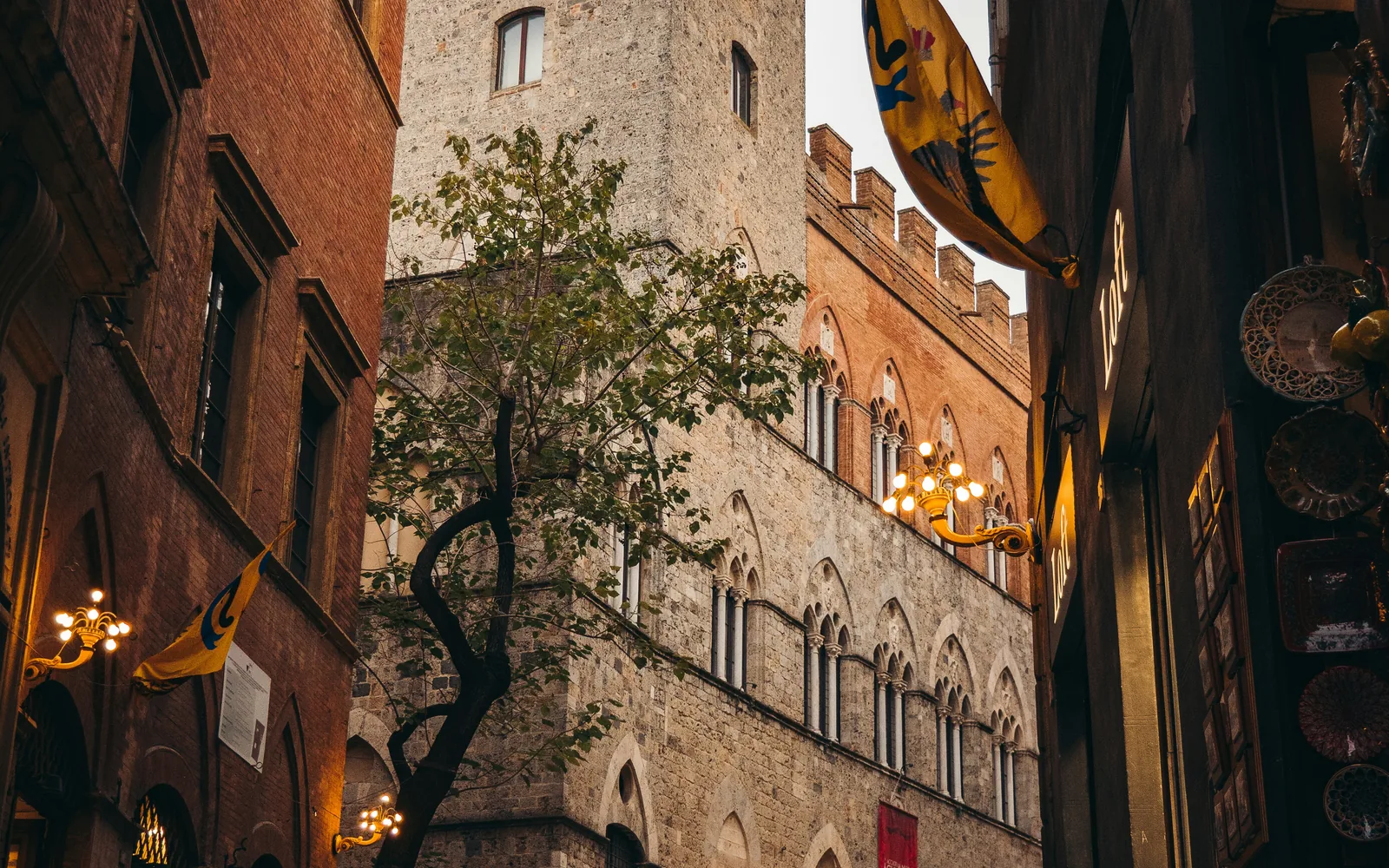
What to look for: plaques on building corners carrying a contrada's arms — those are boundaries, which is why they are on walls rather than at junctions. Lamp brackets and flag holders in contrada colours. And the fontanine, each contrada's own fountain, where new members are received.
Coming down the western slope you cross out of the Terzo di Città; the colours change at corners with no announcement. Twenty minutes of this teaches more about Siena than any museum label.
7. Piazza del Mercato and the view nobody queues for (20 min)
Work your way round below the Campo to Piazza del Mercato, behind the Palazzo Pubblico. From its edge the land drops away into open country almost immediately — Siena has no suburbs in this direction. It is the single best free demonstration that this is a small walled city on a ridge and not a large one, and there is rarely anyone there.
8. Orto de' Pecci, and back up (45 min, optional)
From the Mercato you can descend into the Orto de' Pecci, the green hollow below the city walls — a working garden with benches, and one of the two obvious places to eat the picnic you are not allowed to eat on the Campo.
Be honest with yourself about the return. Going down is free; coming back up is the steepest sustained climb on this route. If your legs are finished, this is the leg to skip.
9. Back to the Campo for the last hour of light
End where you started. The brick warms to a colour that has no equivalent, the Torre throws a shadow across the shell, and the slope fills with people sitting. If you do one thing twice today, do the Campo.
What this route leaves out, and when to add it
This walk stays inside the Città and San Martino sides of the Y. That is deliberate for a first visit, and it means two things are missing.
The Camollia arm. Walking north from the Croce del Travaglio along Via Banchi di Sopra — past Piazza Salimbeni, seat of the oldest bank in the world — takes you into the third terzo and toward the Basilica di San Domenico — the large brick church holding Saint Catherine of Siena's head relic, free to enter — and beyond it the Fortezza Medicea, whose ramparts are a free walking space with the best light-change view over the city. Add roughly an hour and a half. It is the natural second half-day, and it is also the direction the 131R bus from Florence arrives from, so day-trippers often walk it backwards without realising.
The Pinacoteca Nazionale. Sienese gold-ground painting, a short walk off Via di Città, and the collection that explains what the cathedral and the Museo Civico assume you already know. It is a specialist stop rather than a first-visit one — but on a second visit, or a wet day, it is the best hour in the city that nobody queues for.
Walking it twice
The route above is the daylight version. Siena has a second one, and staying overnight is the only way to get it.
Before 09:00 the Campo belongs to deliveries and people crossing to work, Via di Città is empty, and the contrada lanes are silent enough that you hear your own footsteps change surface at a boundary. This is the walk to do on your second morning, without the ticket logistics, without stopping.
After dark the Palazzo Pubblico is lit, the day-trip coaches have gone, and the lanes are lit by the contrada lamps you spent the afternoon learning to notice. The distinction our day trip versus overnight comparison turns on is exactly this: the ticketed city closes at six, and the walkable city does not.
Seasonally, the walk is at its best in late spring and from mid-September through October. In high summer the unshaded brick radiates heat into the evening and the gradients cost more than they should; in deep winter the wind runs down the ridges into the Campo.
The hills, honestly
Siena's route is about three kilometres, which sounds trivial and is not, because almost none of it is flat.
- The Campo is a bowl. Every arrival is a descent and every departure is a climb, including the short one from the Palazzo Pubblico back up to the Croce del Travaglio.
- Via di Città climbs steadily to the cathedral. This is the main ascent and it is manageable.
- The contrada lanes fall and rise repeatedly. They are the pleasure of the walk and the reason it takes longer than the distance suggests.
- Orto de' Pecci is the hard one. A real descent below the walls and a real climb back.
- Surfaces are cobbled and often uneven, with steps in the smaller lanes. Footwear matters more here than in Florence.
Doing this with limited mobility
An honest version rather than an encouraging one.
What works: the Campo itself, though it slopes; Via di Città and the approach to the cathedral, which are gradients rather than steps; the Piazza del Duomo; and Santa Maria della Scala, whose main levels are broadly manageable even though its underground sections are not.
What does not: the Torre del Mangia, which is 400 steps with no lift and carries explicit health warnings; the Facciatone panorama, reached by a climb; the Orto de' Pecci return; and most of the contrada lanes, which have steps.
A workable shortened route: Campo → Croce del Travaglio → Via di Città → Piazza del Duomo → Santa Maria della Scala → back the same way. That is the spine of the city and it contains most of what matters.
What this walk costs
Nothing, if you want it to. The Campo, the Croce del Travaglio, Via di Città, the cathedral square, the contrada streets, Piazza del Mercato and the Orto de' Pecci are all free and always open. That is a genuinely good half-day.
The paid layer, checked 16 August 2026: Museo Civico €10 (€11 booked), Torre del Mangia €10, the combination €15, Santa Maria della Scala €9, the triple €20; and the cathedral's OPA SI Pass at €13, rising to €15 while the marble floor is uncovered — in 2026, from 18 August to 15 November.
Self-guided or guided?
Self-guided works well here because the city is small, the shape is simple once you know the Y, and the pleasure is in wandering rather than in being told things.
A guide earns their fee in two cases. If you want inside a contrada museum — those open by prior arrangement with the individual contrada and there is no drop-in, so a tour that includes one is doing something you cannot easily do yourself. And if you have a single half-day and no appetite for logistics, since a guide absorbs the ticket problem this article opens with.
Otherwise, walk it yourself and use the saved money on lunch two streets from the Campo.
How we checked these details
Checked 16 August 2026, by web research; direct page fetches are blocked in our environment, so this rests on search-surfaced material rather than pages we opened.
Verified: the Croce del Travaglio as the meeting point of Via di Città, Via Banchi di Sopra and Via Banchi di Sotto, separated from the Campo by Vicolo di San Pietro, named for a cross that signposted the routes to Rome, to the north and to Santa Maria della Scala; Banchi di Sopra and Banchi di Sotto as parts of the Via Francigena; Via di Città's former name Via Galgaria and its ascent to the ridge of the earliest settlement; the three ridges and their correspondence with the three terzi; the Museo Civico and Torre del Mangia ticketing rules — not bookable, ticket-office only, 25 people every 45 minutes, tower first on a combined ticket, and the 18:15 summer and 15:15 winter counter closures; the municipal museum prices of €10, €10, €15, €9 and €20; the OPA SI Pass at €13 and €15 with the 2026 floor-uncovering window of 18 August to 15 November; the Campo food prohibition running to 30 September 2026 with sanctions to €480; and Lorenzetti's Good and Bad Government frescoes of 1338–1339 in the Sala dei Nove.
Basilica di San Domenico's association with Saint Catherine, the Fortezza Medicea's ramparts as free public walking space, and the Pinacoteca Nazionale's Sienese painting collection are consistent with our existing Siena coverage. Flagged as unconfirmed: the route distance, which we give as roughly three kilometres from the sequence of stops rather than from a measured track; walking times, which are estimates and will not survive a hot afternoon or a slow lunch; and step-by-step accessibility, which we describe in general terms because we have not surveyed the surfaces ourselves — anyone for whom this is decisive should check their specific route rather than rely on this page.
We have no commercial relationship with any museum, guide or tour operator. No booking made from this page pays us anything, and no tour is recommended.
Final thoughts
Siena rewards walking more than almost any city its size, and it punishes walking it in the wrong order. Get the ticket office out of the way first, learn the junction, then stop navigating and let the lanes take you downhill.
The best twenty minutes of this route are not on it. They are wherever you end up when you stop following the list — a corner where the colours change, a gap between palazzi with thirty kilometres of countryside in it, a fountain with a stone animal on top that means something to everyone who lives on that street and nothing to you yet.